Beinn Chabhair Hike

Where: Beinn Chabhair from Beinglas Farm Campsite in central Scotland
Height: 3,061ft, 933m

Beinn Chabhair is situated up behind Beinglas Farm Campsite, 50 miles north of Glasgow, next to the A82 road.

This Mountain has little Trail and Wet Sections so is normaly avoided by Tourist Hikers.

The image below is of the Drovers Inn at Inverarnan next to the A82, only 200 yards south of the entrance to Beinglas Farm Campsite. The car park at the side of the Inn is for the Drovers Inn customers, so should only be used by hikers using the Inn for accommodation or meals.

The falls behind the Inn are on the route to Beinn Chabhair mountain.

Glasgow to Beinglas Farm Campsite Map.

Drovers Inn by Loch Lomond image

The image below is from the narrow bridge leading to Beinglas Farm Campsite, only about 200 yards north of the Drovers Inn. Access to Beinglas Farm Campsite is only permitted between 7.00am-11.00pm daily. The campsite has a bar and restaurant, and also offers self catering accommodation and small cabins.

Day Hikers can park at the campsite for a small fee of about 2 or 3 pounds. If you are hiking from the Drovers Inn, you can follow the fence round to the right in the image below, round to behind the farm where you will find the trail up past the left side of Beinglas Falls, as seen below, then on to Beinn Chabhair.

Beinglas Farm Campsite image

The image below is from about 1 mile north of Beinglas Farm Campsite looking out to Beinn Chabhair. This image shows it is a good way out along an interesting range.

Most hikers try to do this hike in clear weather and during dry spells as the track is hard to follow, and there are boggy sections during wet spells.

Go up the left side of the falls as the right side can be really hard going.

Large Image

Beinn Chabhair image

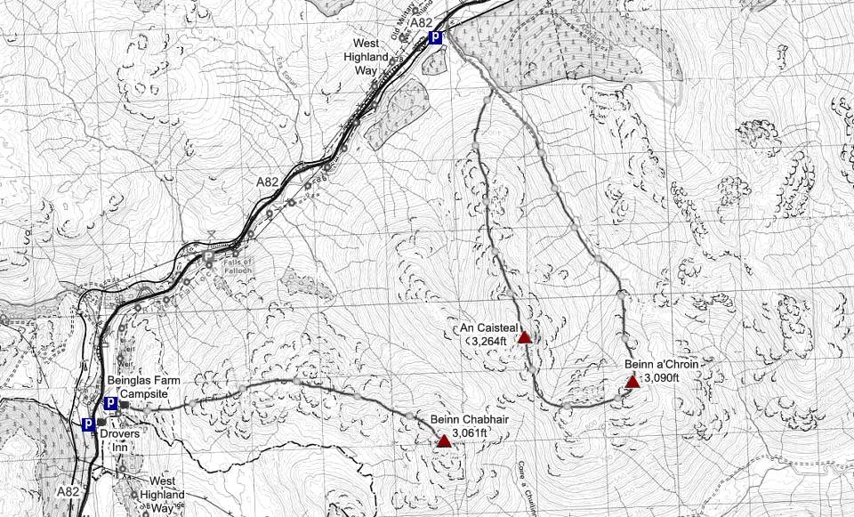
The Map below shows the main route onto Beinn Chabhair by going up behind Beinglas Farm Campsite and out over the range. The route back is to retrace the way out.

Make sure and take an Ordnance Survey Map and Compass on these hikes, and know how to use them, as in cloud, these mountains can be deadly. In Winter, make sure you have Crampons and an Ice Axe, and know how to use them.

Hill Walking OS Map

Beinn Chabhair Photo Tour to the Top.

Beinn Chabhair Map image