Central Scotland Activities & Mountains |
|
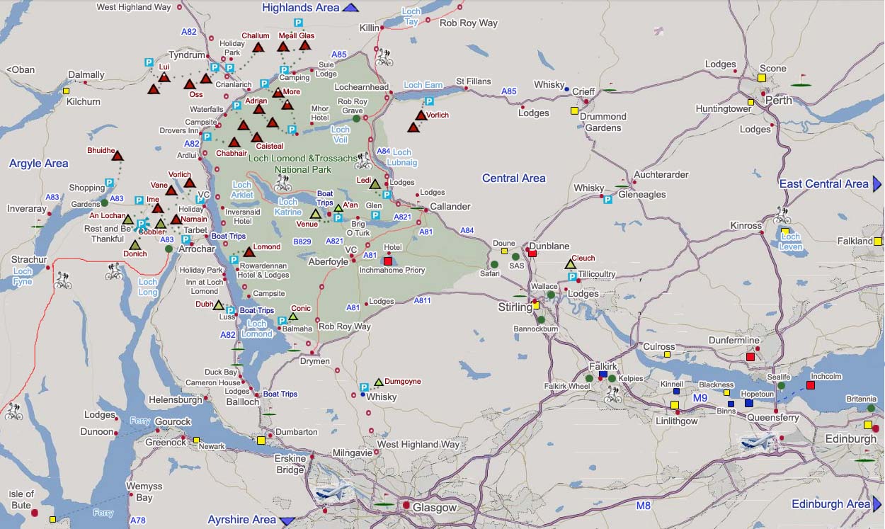
An Interactive Click On Map of Central Scotland showing mountains, hills, activities, hotels and towns. The map shows the main attractions such as towns, mountains up to 3,822ft, golf courses, and historic attractions. Click on the towns for information on that town and accommodation, green dots for attractions, VC for visitor centres, triangles for hills/mountains, and golf flags for golf clubs. |
The Boat Trips have a number of drop off and pick up points around the lochs, hop on, hop off. There are over 20 mountains on the north side of the Loch Lomond and Trossachs National Park over 3,000 ft, known as Munros. These are normally the most hiked in Scotland as they are the furthest south, close to the largest city in Scotland, Glasgow. |
|
 |
|
These mountains should only be climbed with an Ordinance Survey Map and good knowledge of using a Compass. Try to memorize the trail up, and take the direction of the trail with a compass, so if clouds roll over, you can find your way back down. |
Snow or Ice Conditions should only be attempted after ice training, and with the correct equipment. |
|